| |
|
|
|
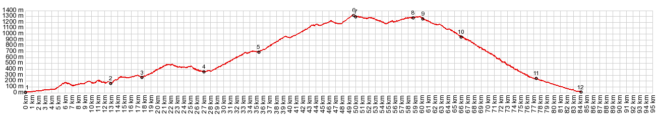
01.(00.0km,020m)START-END EAST: Mediterranean coast, just east of Adra
02.(13.0km,0170m)Al6300 crosses Adra at los Molinos
03.(17.7km,0270m)profile turns left to Embalse de Benina
04.(27.3km,0350m)Embalse de Benina Dam
05.(35.4km,0700m)turnoff to Turon
06.(49.7km,1310m)TOP: Venta de Chaleco - Turon(sh)
07.(50.1km,1290m)Venta de Chaleco intersection
08.(58.8km,1270m)jct with A345 heading north down into valley
09.(60.3km,1270m)Haza del Lino - Albondon summit is on right; but profile stays straight
10.(66.3km,0950m)Albondon
11.(77.5km,0230m)middle Albunol turnoff
12.(94.1km,0020m)START-END WEST: Mediterranean coast, La Rabita
|