|
|
|
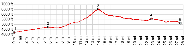
1.START-END EAST:Az92 crosses the San Pedro River
2.route turns south onto Montezuma Canyon Rd
3.TOP, Montezuma Canyon, 6560ft
4.profile turns south onto FR61 Lochiel Rd
5.START-END WEST:FR61 local low point, where FR61 crosses the county line
|
--endhere--