|
|
|
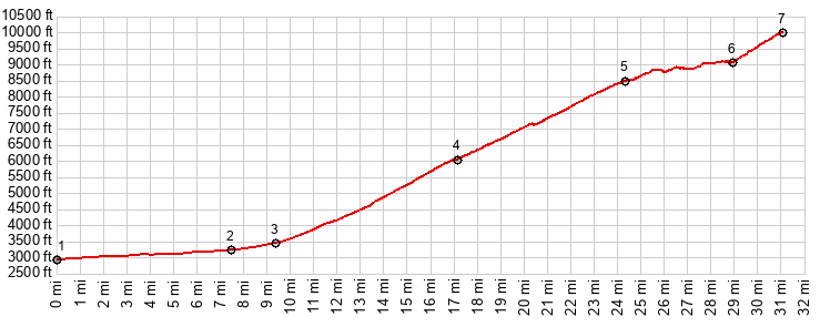
1.START-END EAST:jct US191 - US270 Safford
2.START-END EAST ALT: profile turns right onto Az366, Swift Trail
3.jct with W Boulder Lane
4.turnoff to Wet Canyon Campground
5.road crosses to west side of Mt Graham near Ladybug Saddle
6.profile turns off onto unsigned gravel road, not far from end of pavement
7.TOP, Heliographic Peak, 10000ft
|