|
|
|
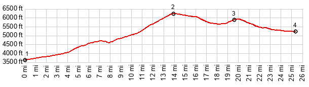
1.START-END WEST: Three Way
2.TOP, 6300ft
3.route crosses into New Mexico
4.START-END EAST: low point at Mule Creek. There are no higher route elevations on Az78 before the jct with US160.
|
--endhere--