| |
|
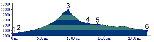
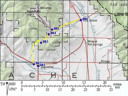
1.(7720ft,mile00) START-END SOUTH: Saguache
2.(7790ft,mile01) turn from Co114 right onto dirt road signed Ute Pass
3.(9944ft,mile09) TOP: Ute Pass, sidetrip to nearby hilltop is on right.
4.(8680ft,mile13) junction with little Columbia Guch road. Continue downvalley towards right.
5.(8590ft,mile14) continue downvalley to right.
6.(7980ft,mile22) START-END NORTH: Villa Grove