| |
|
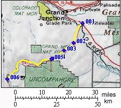
1.(4680ft,mile00) START-END EAST: Whitewater, junction of US50 and Co141
2.(6060ft,mile09) dirt road to Cactus Park and Gibbler Gulch leaves on left
3.(6610ft,mile15) Divide Road (unpaved) leaves on left
4.(7048ft,mile20) TOP: Unaweep Divide
5.(7000ft,mile20) trail to Gill Creek Divide leaves on left
6.(4590ft,mile44) START-END WEST: Gateway