| |
|
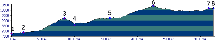
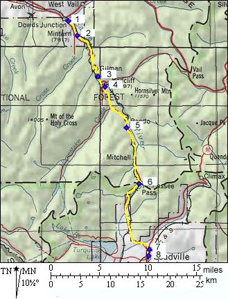
1.(7730ft,mile00) START-END
NORTH: Dowd Junction, connects with Vail Pass
profile
2.(7840ft,mile02) town of Minturn
3.(9267ft,mile08) Battle Hill Summit
4.(8560ft,mile10) START-END NORTH-ALTERNATE: left leads to Redcliff and Shrine Pass profile; straight to Tennessee Pass
5.(9340ft,mile15) north end of Camp Hale, Kokomo Pass profile connects to this point
6.(10424ft,mile22) TOP: Tennessee Pass
7.(10190ft,mile31) junction with Fremont Pass road, continue right to Leadville
8.(10190ft,mile31) START-END SOUTH: Leadville