| |
|
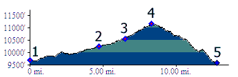
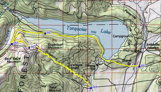
1.(9700ft,mile00) START-END NORTH: southern Turquoise Lake access road, crossing CR9, just east of railroad tracks and Arkansas River Crossing
2.(10240ft,mile05) FR105 diverts on left
3.(10560ft,mile07) profile turns hard left onto FR105A
4.(11160ft,mile09) TOP; profile between here and next point is an aproximation.
5.(9570ft,mile13) START-END SOUTH: unmarked trailhead, near Lake Fork, north of Co300.