| |
|
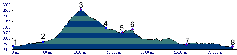
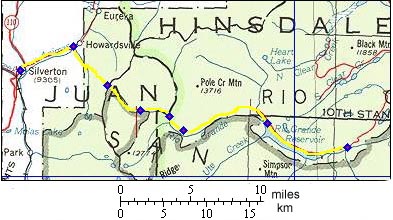
01.(9300ft,mile00) START-END NORTH: downtown Silverton
02.(9680ft,mile05) Howardsville; route turns right
03.(12588ft,mile10) TOP: Stony Pass
04.(10940ft,mile14) junction with Deep Creek road, continue straight
05.(10550ft,mile17) Pole Creek crossing
06.(10790ft,mile18) START-END SOUTH ALTERNATE: Timber Hill
07.(9450ft,mile26) west end of Rio Grande reservoir
08.(9260ft,mile33) START-END SOUTH: River Hill campground