| |
|
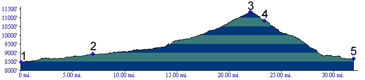
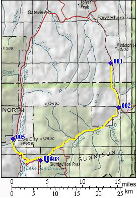
1.(8510ft,mile00) START-END EAST: Cebolla
Creek campground
2.(8920ft,mile07) Cathedral. Los Pinos Pass turns left.
Stay right.
3.(11320ft,mile23) TOP: Slumgullion Pass alternate
summit. Shortly later road merges with paved Co143.
Profile continues to right.
4.(10850ft,mile24) turnoff to Windy Point overlook is on
right.
5.(8660ft,mile32) START-END WEST: Lake City