| |
|
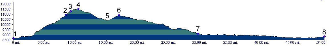
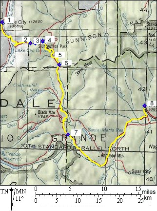
1.(8660ft,mile00) START-END WEST: Lake City
2.(10850ft,mile09) turnoff to Windy Point Overlook is on left
3.(11310ft, mile10) turnoff to Slumgullion Pass alternate summit, leading to Cebolla Creek is on the left
4.(11561ft,mile11) TOP: high point, slightly south of marked Slumgullion Pass
5.(10440ft,mile16) lowpoint between passes
6.(10901ft,mile17) Spring Creek Pass
7.(9100ft,mile30) START-END EAST turnoff to upper Rio Grande Reservoirs is on right
8.(8900ft,mile50) START-END EAST ALTERNATE: Creede