| |
|
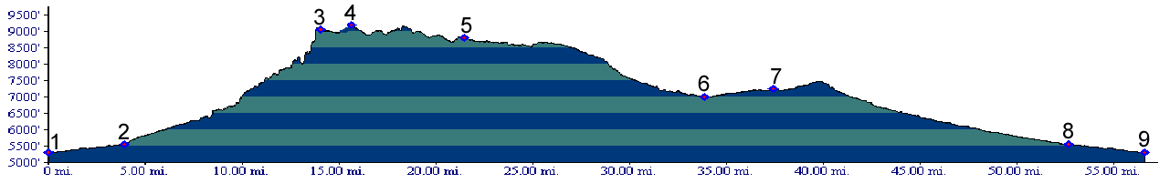
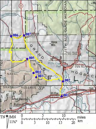
1.(5290ft,mile00) START-END SOUTH-EAST: south end of Rifle
2.(5560ft,mile04) START-END SOUTH-EAST ALTERNATE: take turnoff onto 245rd road on left
3.(9050ft,mile14) route to Anvil Points is on left. Profile continues on right
4.(9220ft,mile16) TOP: high point along route, in vicinity of a turnoff leading to Long Ridge
5.(8800ft,mile22) continue straight, route turns away from edge of plateau
6.(7000ft,mile34) Cow Creek Road terminates. Go right to Rio Blanco
7.(7250ft,mile38) go right on Co13 back to Rifle.
8.(5560ft,mile53) START-END SOUTH-WEST ALTERNATE: same as point 2
9.(5290ft,mile57) START-END SOUTH-WEST: same as point 1