| |
|
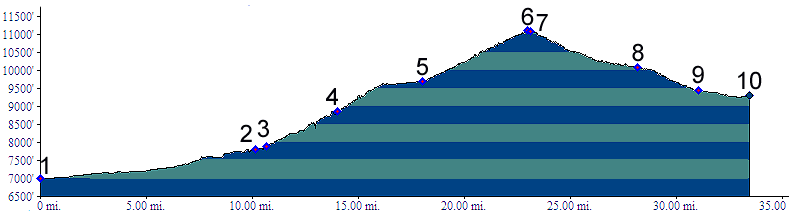
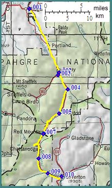
01.(7000ft,mile00) START-END NORTH ALTERNATE: Ridgway turnoff on US550.
02.(7800ft,mile11) START-END NORTH downtown Ouray
03.(7890ft,mile11) turnoff to Imogene Pass trail is on right
04.(8870ft,mile15) turnoff to Denver and Engineer Passes is on left
05.(9700ft,mile19) Ironton Park, turnoff to Corkscrew Pass is on left
06.(11100ft,mile23) TOP: Red Mountain Pass
07.(11080ft,mile24) turnoff to Black Bear Pass is on right
08.(10100ft,mile29) turnoff to Ophir Pass is on right
09.(9440ft,mile31) turnoff to South Mineral Creek Road is on right
10.(9290ft,mile34) START-END SOUTH: downtown Silverton