| |
|
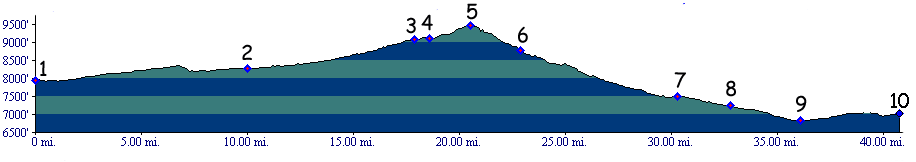
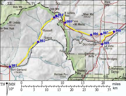
01. (mile00,7946ft) START-END WEST: Fort Garland
02. (mile10,8273ft) dirt road turn off leading to railline is on right, stay straight
03. (mile17,9071ft) dirt road turn off to western approach Old La Veta Pass is on right, stay straight
04. (mile18,9108ft) dirt road turn off to dirt road Pass Creek Pass is on left, stay straight
05.(mile20,9413ft) TOP: NORTH LA VETA PASS
06. (mile22,8783ft) dirt road turn off to eastern approach of Old La Veta Pass is on right, stay straight
07.(mile30,7500ft) shorter alternate route for fat tires to La Veta is on right
08.(mile32,7225ft) another possibility to cut off a mile or two to La Veta is on right.
09.(mile36,6820ft) ALTERNATE START-END EAST : turn off toLa Veta is on right, go right
10.(mile41,7030ft) START-END EAST : town of La Veta