| |
|
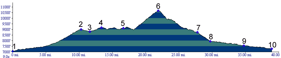
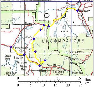
01.(7040ft,mile00) START-END EAST: Ridgway
02.(8970ft,mile11) Dallas Divide
03.(8820ft,mile12) profile continues right up unmarked dirt road to Hastings Mesa
04.(9160ft,mile14) Hastings Mesa summit(u)
05.(9110ft,mile17) continue up to left on Last Dollar road
06.(10663ft,mile23) TOP: last Dollar Pass
07.(8740ft,mile28) approach to Telluride continues straight, profile turns right
08.(7960ft,mile30) junction with Co145, profile continues right
09.(7550ft,mile35) Sawpit
10.(7300ft,mile39) START-END WEST: junction Co62 and Co145 near Placerville