| |
|
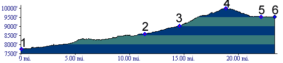
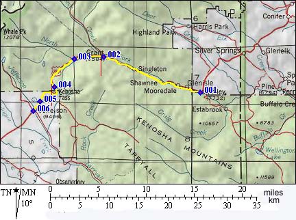
1.(7740ft,mile00) START-END EAST: Bailey
2.(8580ft,mile12) Grant, dirt road on right
3.(9020ft,mile15) Webster and junction with Hall Valley on right
4.(10001,mile15) TOP: Kenosha Pass
5.(9540ft.mile19) junction with Lost Park dirt road on left
6.(9500,mile24) START-END WEST: Jefferson