| |
|
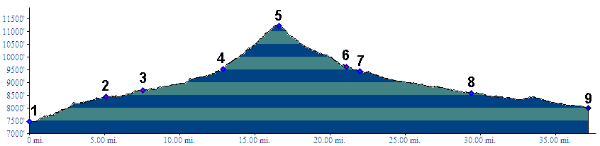
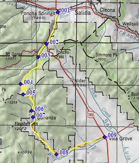
1.(7480ft,mile00) START-END NORTH ALT.: Poncha Springs, jct US50 - US285
2.(8440ft,mile06) route turns right onto Marshall Pass Rd
3.(8700ft,mile08) START-END NORTH: profile turns left up Silver Creek Rd, near Shirley townsite trailhead parking lot
4.(9500ft,mile14) profile turns hard left, up FR869 Toll Road Gulch
5.(11220ft,mile17) TOP
6.(9620ft,mile21) jct with several forest roads near Bonanza Mine
7.(9440ft,mile22) Bonanza
8.(8580ft,mile30) road following Columbia Gulch joins from right
9.(7990ft,mile38) START-END SOUTH: road ends onto US285, just north of Villa Grove