| |
|
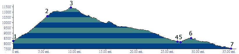
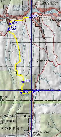
1.(8230ft,mile00) START-END SOUTH: jct Co149 - FR868, north of Lake City
2.(10610ft,mile06) crest of FR868, route turns right onto FR867
3.(11430ft,mile10) TOP
4.(8190ft,mile27) START-END NORTH: FR867 ends at US50. Profile turns right towards Blue Mesa Reservoir
5.(8160ft,mile28) intermediate low point
6.(8500ft.,mile29) intermediate high point
7.(7530ft,mile36) START-END NORTH ALT. : US50 crosses a bay of Blue Mesa Reservoir.