| |
|
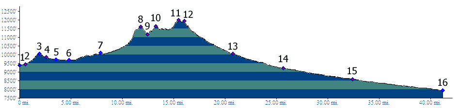
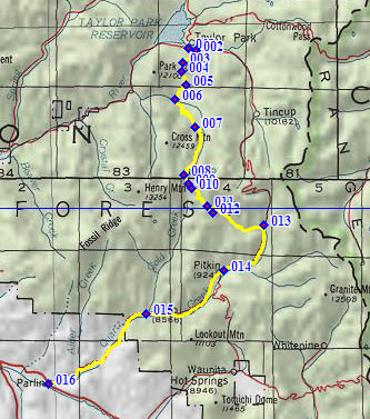
1.(9380ft,mile00) START-END NORTH: southern end of Taylor Reseroir. Dirt road branches off FR742, signed Union Park
2.(9430ft,mile01) route turns right onto FR752, signed Union Park
3.(10070ft,mile02) intermediate summit
4.(9870ft,mile03) profile stays right
5.(9720ft,mile04) route goes right to go around west side of Union Park
6.(9580ft,mile05) Union Park cow camp. Begin Gold Creek Trail shortly thereafter
7.(10090ft,mile08) jct with Cameron Creek Trail; profile continues left on Gold Creek Trail
8.(11620ft,mile12) intermediate summit point; Cameron Creek Trail rejoins route on Shaw Ridge. Profile between here and summit is an approximation
9.(11180ft,mile13) Profile turns left onto a trail labeled "Fairview Peak"
10.(11620ft,mile14) intermediate summit point
11.(12010ft,mile16) TOP
12.(11950ft,mile16) Fairview Mine
13.(10050ft.mile21) START-END SOUTH: FR766 joins Cumberland Pass Rd and turns downhill to the right
14.(9200ft,mile26) Pitkin
15.(8590ft,mile33) Ohio City
16.(7960ft,mile42) START-END SOUTH ALTERNATE: Parlin