| |
|
|
|
-
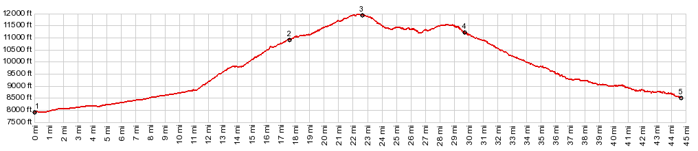
1.(mile00,7910ft) START-END EAST: Del Norte: jct US160 - Pinos Creek Rd
2.(mile17.6,109010ft)profile stays left on FR20
3.(mile22,6,11920ft)TOP: Greyback Mtn s(u), just before turnoff to one way track to top of that mountain
4.(mile29.7,11250ft)START-END WEST ALT: jct with FR360 to Prospect Mtn s(u). Profile stays right, continuing downhill
5.(mile44.7,8530ft( START-END WEST: jct US160 - Demijohn Rd, west of South Fork
|
|
-