| |
|
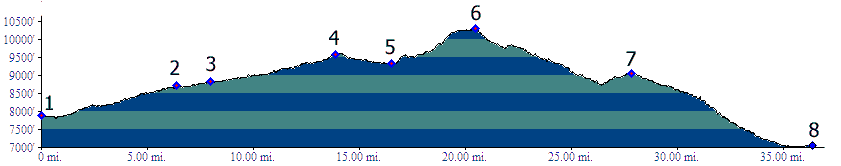
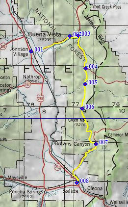
01.(7890ft,mile00) START-END NORTH: US285 turns
east out of Arkansas Valley, at Johnson Corner.
02.(8710ft,mile07) route turns right onto FR187
03.(8820ft,mile08) route turns right onto FR185
04.(9590ft,mile14) profile takes right at this
fork onto less traveled FR185B
05.(9330ft,mile17) intermediate low point
06.(10310ft,mile21) TOP
07.(9040ft,mile28) route joins FR175
08.(7050ft,mile27) START-END SOUTH: downtown
Salida