| |
|
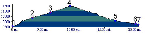
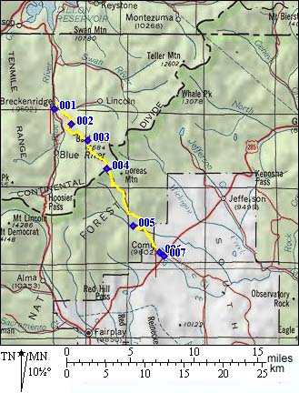
1. (9594ft,mile00) START-END NORTH: Breckenridge
2. (10363ft,mile04) beginning of Boreas Pass railbed trail
3. (10854ft,mile07) Baker's Tank watertower for steamengines
4. (11481ft,mile10) TOP: Boreas Pass
5. (10093ft,mile17) continue to left downvalley
6. (9800ft,mile20) START-END SOUTH ALTERNATE: Como
7. (9681ft,mile21) START-END SOUTH: junction with US285