| |
|
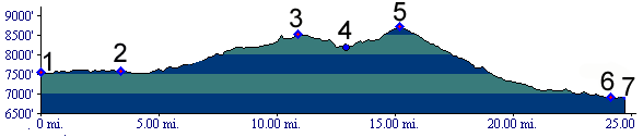
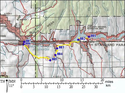
1.(7530ft,mile00) START-FINISH EAST: US50 crosses Blue Mesa Reservoir from north to south.
2.(7580ft,mile03) camper community of Sapinero
3.(8500ft,mile11) intermediate summit
4.(8300ft,mile13) low point between summits, junction with dirt road ascending East Fork of the Little Blue River.
5.(8704ft.mile16) TOP: Blue Mesa Summit
6.(6880ft,mile25) START-FINISH WEST: settlement of Cimarron. Route continues down Cimarron Canyon on the right
7.(6700ft,mile25) START-FINISH WEST: low point in Cimarron Canyon before road ascents to Gunnison Dam.