| |
|
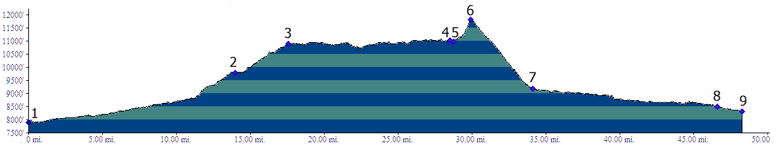
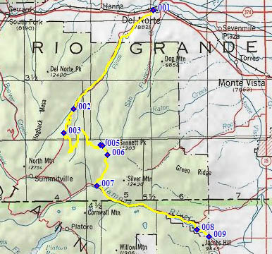
1.(7900ft,mile00) START-END NORTH: jct US160 - FR14, just west of Del Norte
2.(9830ft,mile14) START-END NORTH ALTERNATE: Elk Park, jct with Shady Creek Trail on right
3.(10900ft,mile17) profile stays left on FR329
4.(11040ft,mile29) Burro Creek jeep road joins from left
5.(10980ft,mile29) Bennet Creek Trail joins from left. Road. Take right uphill
6.(11780ft,mile31) TOP: Blowout Pass, also jct with TR700
7.(9170ft,mile34) START-END SOUTH ALTERNATE: route goes left down FR250 towards Jasper at this T
8.(8500ft,mile47) below spillway of Terrace Reservoir
9.(8320ft,mile49) START-END SOUTH: FR250 crosses Alamosa river easth of Terrace Reservoir