| |
|
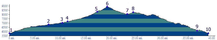
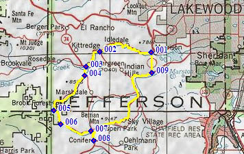
01.(5800ft,mile00) START-END EAST-NORTH: Morrison; profile goes up Bear Creek Canyon
02.(6820ft,mile08) Parmalee Gulch Road to Dix Saddle leaves on left
03.(7040ft,mile11) jct Co73 - Co74 in Evergreen, profile continues left
04.(7190ft,mile12) profile turns off left onto right busy Brook Forest Road
05.(8340ft,mile17) Cub Creek Park
06.(8920ft,mile20) TOP
07.(8050ft,mile24) profile turns left ont Co73
08.(8270ft,mile25) profile turns left(east) onto US285
09.(6120ft,mile37) profile turns off US285 and heads north on Co8
10.(5800ft,mile39) START-END EAST-SOUTH: Morrison, same as point1