| |
|
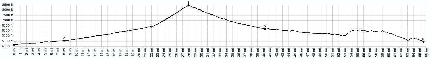
1.(4660ft,mile00.0) START-END SOUTH: county road reaches a low point, just before crossing Salt Creek, north west of Mack
2.(5040ft,mile08.0)road enters Book Cliffs area, shortly after jct with Mitchell Rd
3.(64000ft,mile22.1) route turns left in Atchee
4.(8380ftft,mile28.1) TOP: Baxter Pass
5.(6180ft,mile40.5) START-END NORTH: jct with road on right that also climbs towards south
6.(4990ft,mile65.7) START-END NORTH ALT: low point at bridge over White River, south of Vernal, Ut
|