| |
|
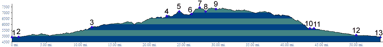
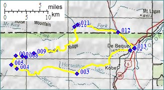
01.(4910ft,mile00) START-END
SOUTH-WEST: Colorado River Bridge, south of de Beque
02.(4930ft,mile01) turn right to Deer Park
03.(5750ft,mile12) stay right
04.(6710ft,mile23) first turn off to Bronco Flats on left, stay right
05.(7100ft,mile25) two turnoffs on left dead end, also the top on the Wild Horse Trail
06.(6900ft,mile27) take turnoff to Corcoran Peak trail on double track trail on right
07.(7470ft,mile28) TOP: high point below Corcoran Peak
08.(7120ft,mile29) left leads back into valley; stay right
09.(7320ft,mile30) trail joins a larger dirt road coming from down valley
10.(5650ft,mile44) BLM7058 joins South Dry Creek road
11.(5640ft,mile44) South Dry Fork joins Dry Fork. Continue straight.
12.(5100ft,mile50) Dry Fork joins Roan Creek. Turn right.
13.(4910ft,mile54) START-END SOUTH-EAST: same as 1