| |
| |
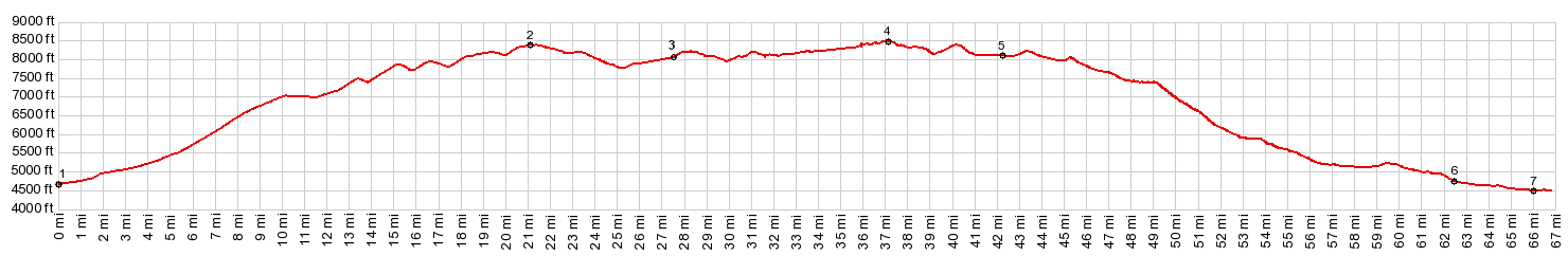
CR3 Hazelton Road northern
summit s(u)
The name Hazelton Road strings
across the Bighorn Range south of Buffalo and then
continues down its western side. This profile
below combines part of this long Hazelton Road
with the Rome Hills Road, to form a route across
the Bighorn Mountains, crossing south of Powder
River Pass at a lower elevation.
The most interesting part of Powder Pass it the canyon on its west side. What is true for Powder River Pass is also true for this route. The most scenic section on also on on the lower west side, when the road comes in contact with the cliff forming formations, that also make up Tensleep Canyon on the Powder River Pass road. But this road stays closer to the erosional surface and does not follow a canyon.
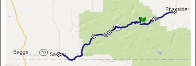
Approaches From East. (described
downwards). A group of homeowners have made
themselves at home on the north side of the lake.
Public access to the lake is limited to walk-in,
with a staircase over a fence. Continuing on the
road, the first right on "Gold Mine Road" is a
good connection to the east side of Powder River
Pass. But this profile takes the following right
onto Rome Hills Road. Hazelton Road itself
continues south and further downhill over other
summit points. Many parts of Rome Hill Road are heavily
gravelled - little problem riding a mountain bike
downhill - that saves on breakpad wear. But it is
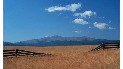
a lot of extra work climbing. A fast straight line
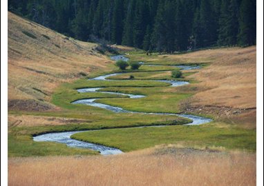
leads downhill on rangeland. In the distance the
high peaks around Cloud Peak make a fascinating
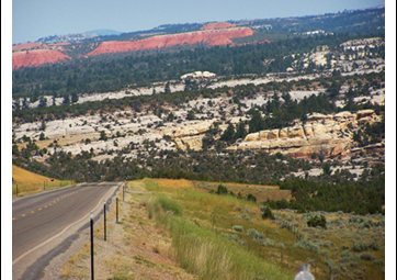
background behind gigantic waves of prarie land. Finally the strike slopes of the Tensleep
badlands appear, wave after wave of red and creme
colored lips of rock, in a way pounding the shores
of the Bighorns from below. The road becomes more
easily ridable here. For a short time the road
follows the edge of a canyon, that from the view
could easily be located in southern Utah, except
that here it is fenced off as private land. The
last part of the road is paved and connects to the
Powder River Pass road a few miles east of
Tensleep
A Dayride with this point as intermediate
summit is located on the page: Powder
River Pass |
|
|
advertisement |
|
|
advertisement |