| |
| |
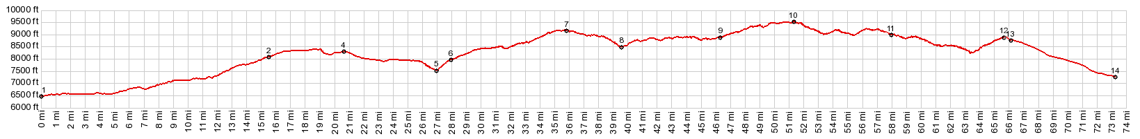
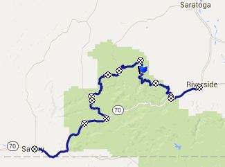
FR543 South Spruce Creek
s(u)
I thought that this forestry
road, running through the trees, would turn out to
be the highest point on a ride around Bridger Peak
in the Sierra Madre. But - surprisingly - the
paved Battle
Lake Pass actually turned out to be higher.
Still this is not an easier way to cross the
Sierra Madre.
After crossing the FR830
Deep Jack Trailhead s(u) point, the direct
approach from Saratoga meets with the profiled
road. They meet at a curiously signed
intersection, stating Saratoga 20 miles and
Encampment 29. Looking at a map this seems
counterintuitive, because Encampment is much
closer as the crow files. This option follows the
Encampment 29 directions and all its curves. - All
very confusing, best to just look at the
interactive map on the profile page. The profile route becomes quite a bit rockier after the intersection. Still progress is reasonably fast. After being figuratively buried in pine beetle trees for the longest time, approaching the summit there are a few good views. The first temptation to think that the summit is reached comes at a sign to the "Chipewa Blowdown", a rare tornado in this area that leveled 350 acres of trees in 1967. It took two years for the trees to be harvested.- The actual highest point on the road comes a little later on this endless traverse around the trees. 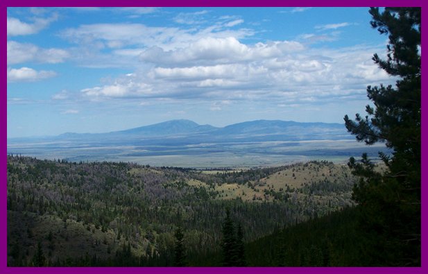 In the center is the historic Rattlesnake Pass in the Laramie Mtns, as seen from near summit of FR543 From East. (described
downwards). The public map on my gps shows a whole
host of roads, at least one of which is a straight
connection down to Wy230 between Encampment and
Saratoga. But reality is different. The road
reaches a low point at the mouth of a ravine -
looking at this on the map it is a large obvious V
shape. Past that point, the road climbs again to
meet Wy70 on its course to the top of Battle Creek
Pass. No other options to descend east exist
before that. A Ride with this point as intermediate summit
is on page: Battle Lake
Pass 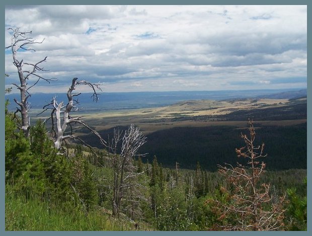
Fremont Expedition: (<Daniel's
Summit(ut) | Muddy Pass(co)>):
During his return from California during his
second expedition, Fremont crossed the Sierra
Madre by going up Battle Creek, and then using one
of the many Indian trails to the north of Bridger
Peak. Marshall Sprague describes this in his book
"The Great Gates". On the other side their trail
led them to Jack Creek. That is the approximate
crossing of this forest road or less possibly two
others further south, which also funnel into Jack
Creek. |
|
|
advertisement |
|
|
advertisement |