| |
| |
FR401 Sage Creek Rd s(u)
This is one of Wyoming's many
wide and windy unpaved Continental Divide
crossings, also a part of the Great Divide
mountain bike touring route. Four roads meet at
the top: Sage Creek Rd, Mc Carty Creek Rd and Deep
Creek Rd and Hydrology
road (and another track which really can't
be called a road). Hydrology Road is also rougher
than the other three, and hardly used at all. It
goes just a little higher and therefore has its
own page.
During my ride in 2015 the road was being
reworked into a major high speed raceway through
the high dessert, complete with banked turns and
hard medalled surface. The road rolls along, so
that it is difficult to tell without an altimeter,
weather overall I am gaining or loosing elevation
with each roll and climb repetition. Approaching the top, the road shifts to the east
and presents a few nice vantage points on itself
with the sage receding into infinity behind it.
The top has far views in all major directions,
including down direction Rawlins for the first
time. The town itself is still hidden behind a
ridge. The top is easy to miss, since there are no
signs of any sort. There are sandy tracks,
branching off the summit, following along the
Continental Divide in each direction for miles. On
the north side this is signed as Hydrology
Road, while on the south side a rocky track,
that is not ridable follows the divide to meet up
with Mc Carty Road. From North. (described downwards) A fast descend leads into a landscape of lips. Linear distant lines of cliffs show off the large proportions of central Wyoming. Several turnoffs to the left invite for more exploration on a bicycle, even though I wonder if anybody has actually ever ridden these roads, immediately adjacent to the Great Divide touring route. After the descend comes one of my favorite
Wyoming camping opportunities, Teton Reservoir,
even if the Teton mountains are in an entirely
different corner of the state. From here the
profile climbs through a shallow gap in the set of
cliffs, that still separate me from Rawlins. After
many miles of solitude the town finally appears as
a small collection of rectangular buildings and
parking lots lining I70. On first appearance the
core of the town appears picturesque and historic.
There is a larger, more modern big box store array
of gigantic parking lots two miles to the east. 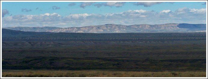 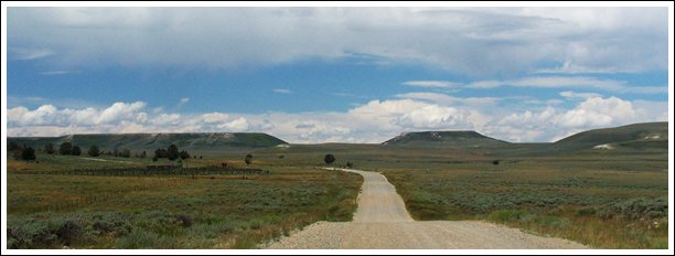 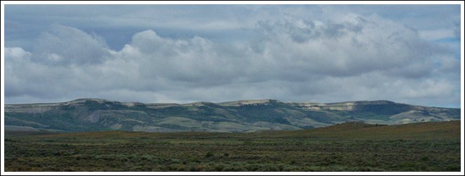
the landscape of lips The profile below shows the
South-1 approach from above, with the South-2
approach, described below
A Dayride with this point as
intermediate summit is on page: Wy70 Battle
Lake Pass Rd - FR801 Deep Creek Rd(sh) 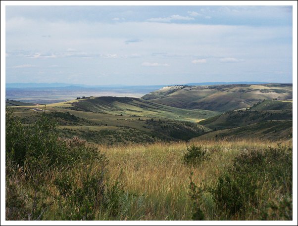 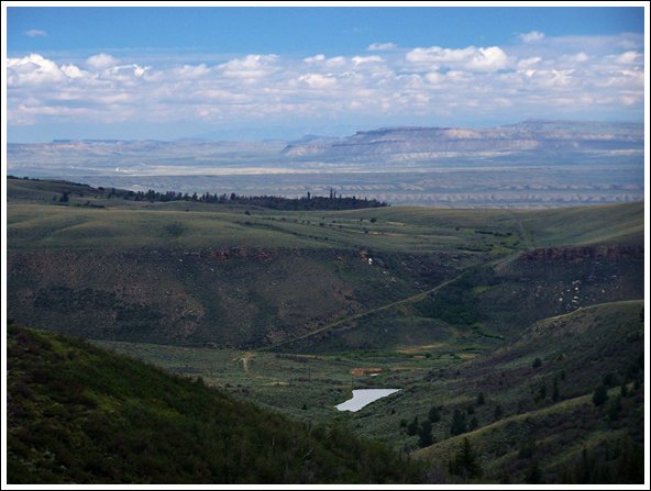
|


 From South2-2: Turning
right onto Mc Carty Canyon Rd - CR573, immediately
north of the summit, a graveled road reaches
another low point at the turnoff to Rawlins
Reservoir. From here a short climb with less than
300ft elevation gain reaches another high point on
Mc Carty Canyon Road.
From South2-2: Turning
right onto Mc Carty Canyon Rd - CR573, immediately
north of the summit, a graveled road reaches
another low point at the turnoff to Rawlins
Reservoir. From here a short climb with less than
300ft elevation gain reaches another high point on
Mc Carty Canyon Road.|
|
advertisement |
|
|
advertisement |