| |
| |
CR752 - CR501 Brown's Hill
s(u)
Three roads meet at a point in
Wyoming rangeland isolation. Two of them belong to
the historic Savery Stock Driveway. There are many
points that meet that description. What can I say,
this is Wyoming. And this page is not about that
point, but about a minor summit, encountered on
the third of these approaches, an almost
imperceptible summit point on the Mc Carty Canyon
Road. But in this area I got the best pictures on
a day long loop ride. So it gets a separate page.
There are other ways to approach this point
separately on the many gravel tracks in the area.
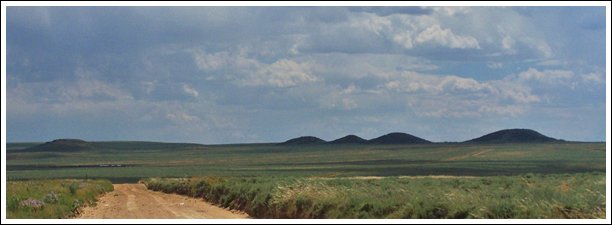
Approaches But up ahead is a very recognizable line of
mountains. The most recognizable is the solid
trapezoid shape of Battle Mountain, after which Battle Lake
Pass is named. Behind it are more
rectangular mesas as well as perfectly rounded
mountains grouped around Hahn's Peak in Colorado.
This road only bends now and then and meets a
summit point at the junction with CR752 Stock
Drive Rd (also called the Savery Stock Driveway).
Brown's Hill refers to the area north of there.
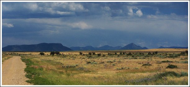
From South. Stock
Drive Road heads for a higher, more easterly point
on the Battle Lake Pass Road. But it was deeply
rutted and muddy when I passed through here.
Instead the profile descends in a straight line to
Savery, and that is the place where I also got the
best late afternoon light on the mountains to the
north. But the road is only straight on a map, or when
viewed from above. In profile it is a series of
bends. I want to call them rolling hills, but
actually they seemed steeper, than just rolling.
The road descends straight into Savery, passing
the pioneer museum, and the center of town, with
its sign saying: Inhabitants: 25. A Dayride with this point as intermediate
summit is on page: FR401
Sage Creek Rd s(u) |
|
|
advertisement |
|
|
advertisement |