| |
| |
CR67 Slip Road Southern
summit s(u)
In his book "The Great Gates"
Howard Spraque lists two historical passes in the
lower southern part of the Bighorn Mountains:
Fraker Pass and Dullknife Pass. Both of these play
an important role in the fight between Chief
Dullknife and the US army. Fraker Pass is on
private ranch land, and it's not even clear if
there is a road there. Dullknife Pass is a very
low pass in between red hogback cliffs on the east
side, and much too hot to cycle when I was there.
However, looking on the map, there is a road
winding up the same eastern slope, apparently
with more switchbacks than you could ever
reasonably expect from an American road, where
slicing through the mountain is always the
preferred option. That is Slip Road.
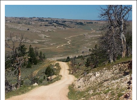
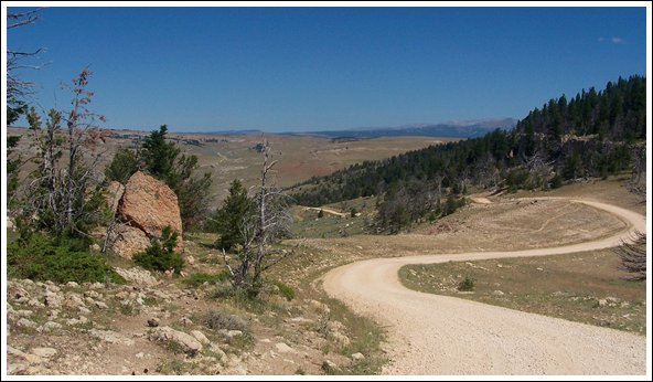
Unfortunately the surface is deep gravel. So
this is also not the perfect bike ride. But the
scenery makes an excursion worthwhile
Approaches
From South. Before Wy191, leaving from Kaycee, arives at the indistinct collection of megafarms, termed Mayoworth, a road branches left and heads immediately for the slip slope of the Bighorn Mountains. What follows is a staircase of tight switchbacks, that have a regularity like no other pass road that I have seen in North America. As already mentioned, unfortunately the surface is a deep gravel that makes riding a mountain bike difficult at best. After about 2500ft of this the road breaks out
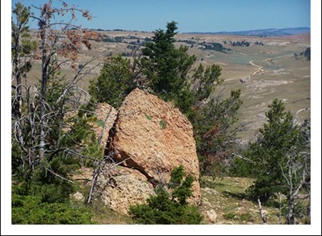
into a high range land, bordered by stark
monuments of dead trees and chunks of white
sandstone caprock. The road reaches a summit
point, from where you can see the next highpoint
on the road. It certainly feels and looks like
this is the higher of the two points. But the
gps tells a different story.
From North. (described
downwards) It would have been just as easy to
build a road following the broad bread
loaf like ridge line to the southern summit.
Instead the road builders decided on a short,
extremely steep decent into a bare, shallow but
still scenically interesting valley, lined with
Mississippian limestone looking caprock at half
height. I suspect that the name "slip" comes
from this portion, because that's what you do as
you go down. The description of the next uphill
is on the CR67
Slip road southern summit page. A Ride with this point as intermediate summit is on page: CR67 Slip Road northern summit. |
|
|
advertisement |
|
|
advertisement |