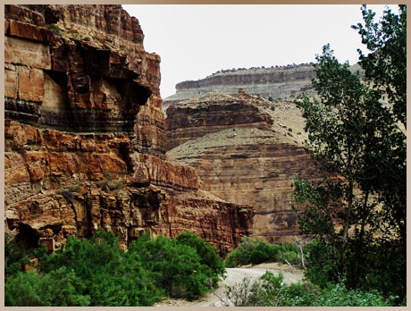
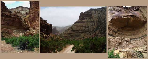
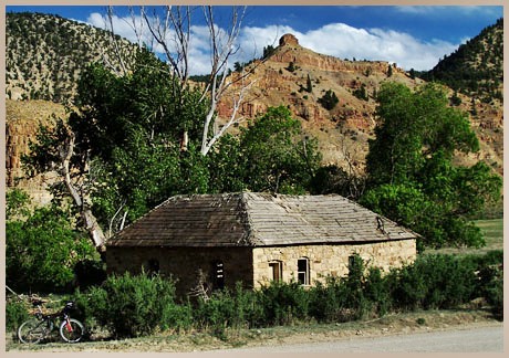
Nine Mile Canyon Road Summit

This very shallow summit possesses many aspects typical of a summit in the Book Cliffs area: uniform layer cake canyon geology with a myriad of gas wells in an isolated area. What is special about this pass is the lower canyon on its western approach. The thirty some mile long canyon, mysteriously named Nine Mile Canyon, has a wealth of Indian petroglyphs from the Fremont period, as well as old homesteads from a period when the route was part of the main road between Price and Vernal. For the most part this is an elaborately engineered all weather dirt road that lacks the scenic intimacy of other MTB routes, like the ride over Bruin Point summit(u) , but is perfectly ridable in a fast aerobic style. Parts of it may be quite bumpy. Older state maps mark this summit with a pass symbol.


01.(5400ft,mile00) START-END WEST: junction US6, Nine Mile Canyon Road
02.(7501ft,mile18) TOP: Nine Mile Canyon Road summit(u)
03.(6930ft,mile21) road from Minnie Maude Creek joins from left
04.(6810ft,mile23) road from Sulphur Creek joins from left
05.(6600ft,mile25) road from Cow Creek joins from right
06.(6090ft,mile32) road from Argyle Creek joins from left
07.(5800ft,mile39) road from Gate Canyon joins from left
08.(5440ft,mile44) road from Dry Canyon joins from right
09.(5430ft,mile44) Daddy Canyon Complex petroglyph area
10.(5380ft,mile45) road from Cottonwood Canyon joins from right
11.(5320ft,mile47) START-END EAST: gate over road

Approaches

From East. Paved Nine Mile Canyon Road, on maps also referred to as Soldier Canyon, leaves from US6 a short distance east of Wellington and heads for the Book Cliffs to the north. The road is used by double trailer coal trucks that are typical for this part of Utah. But in my case traffic was so light that this did not present a problem. The road climbs between shallow ravines to moderate height at the entrance of the Book Cliffs, where they seem about half as high as seen from US6. The pavement ends about 5 miles further at a second coal mine. The canyon becomes shallower and crests in a wide plateau valley while turning north. 


From West. The route is described in a downward direction. A short shallow descent leads to the first labeled group of petroglyphs. The road descends further through various old homesteads, gas wells and pictographs. Close to the bottom, the Daddy Canyon complex is a strange combination of an organized hiking trail between pictographs, adjacent to a gas processing facility and parking lot big enough to serve a convention center, usually with less than 2 cars parked. The short section of road from here, downcanyon to where it ends at a private gate, is by far the most scenically interesting section of the road. Just when it gets interesting you have to turn around. Considering the isolation of this road, it can have a surprising amount of traffic on some weekends, consisting of gas well traffic, archeological tourists, and locals using the road as a shortcut between Carbon county and the Vernal, Duchesne area. All pictures, except for the second one, are taken in the last few miles of the lower descent on this side.


Tours

Dayrides. An out and back ride starting at a campsite near the area where the road enters the Book Cliffs to the end of Nine Mile Canyon road and back, going over the summit twice, measured 76 miles in 7 hours. The cyclometer measured altitude gain of more that 7000 feet was wrong because of a passing weather front (m3:06.5.25).

A ride beginning on US6, climbing through Sunnyside to Bruin Point summit(u), descending through Dry Creek Canyon, then climbing over this summit back to the starting point measured 89 miles with 7500 feet of climbing in 8.2 hours (m3:06.05.27).


Copyright (C) 2003-2008 by Michael Fiebach - All Rights Reserved