Approaching Zion National Park
from the west, heading through Virgin, you can
see this road cut, if you know it is there. It
is a steep exposed rockcut up the Mesa on the
north side of Ut9. If you don't know it's there,
you probably won't see it, It blends well into
the pronounced rock statification lines of the
mesa. The summit point connects this scenically
spectacular, short one way paved climb, with an
unpaved continuation to make a gravel loop out
of the whole ride.
The paved climb to the mesa is relatively short
and steep. But the exposure and the constant great
view make it seem longer and higher. On top of the
mesa, the only legal way to continue is to take
the elaborately signed dirt turnoff on the right.
The road works itself up higher points of the mesa
in a roller coaster fashion. The top section goes
along a gentle ridge with private grazing areas on
both sides, and ultimate views of Zion precipes to
the east, the Pine Valley Range to the west.
From North. (described
downwards) The surface is not quite as perfect on
this side, but still close to perfect. The way
back north is on a slightly lower section of the
same plateau, here called Smith Mesa. The last
section goes through Zion National Park, before
joining the Kolob Terrace paved road back to Ut9.
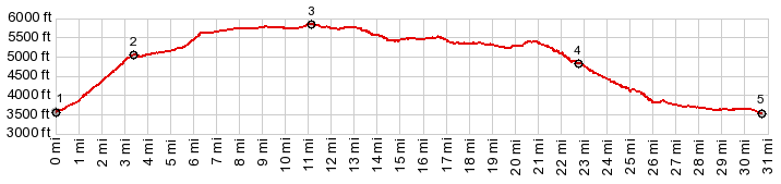
Dayride with this point as highest summit PARTIALLY PAVED / UNPAVED ( < Kolob Canyon(ow) | Smithsonian Butte Rd - Goosberry Mesa Rd(sh) > ) Hurricane Mesa s(u) , additional out and back : jct Mesa Rd - Sand Dirt Road > Mesa Rd north > Hurricane Mesa s(u) > Smith Mesa Rd south > Kolob Reservoir Rd south > Pocketville Rd south with short detours > Ut9 west <> out and back on Sheep Bridge Rd south to turnaround point after 2.3 miles > back up Mesa Rd north to starting point: 38.1miles with 3400ft of climbing in 4:29hrs (garmin etrex30 m3:19.10.15). 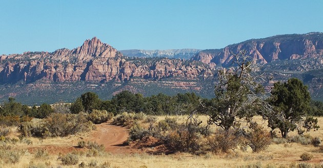 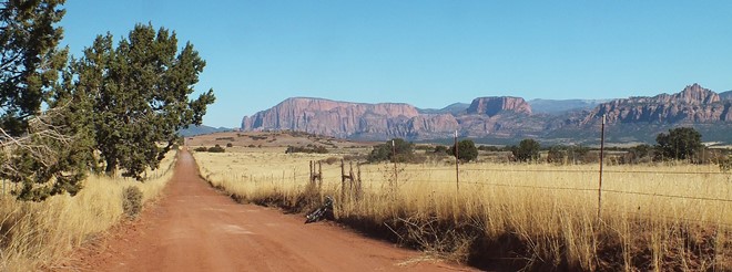 |