|
|||||||||||||||||
|
|
|||||||||||||||||
| |
|
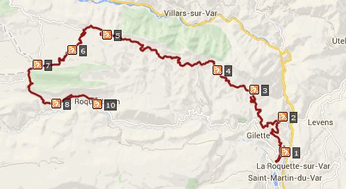
D27 Ascros s(u)
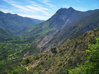
This route traverses on a high ridge parallel to the distant
Mercantour Rage in a rolling climb. It passes several named
passes as shoulder summits, but the views of all the
hilltowns along the way, is really the most special thing
about this route. Several other approach options converge
near the summit. So it is possible to ride to this point and
not come across any of the pictures below. - From a scenery
standpoint the out and back ride to Mt Vial has the best
views of the Haute Alps to the west, that I have come
across.
Approaches At the junction with the river Esteron the bike path takes a
scenic detour, and Nice traffic quickly recedes into distant
memory. Here D17 starts to climb to the first, and arguably the
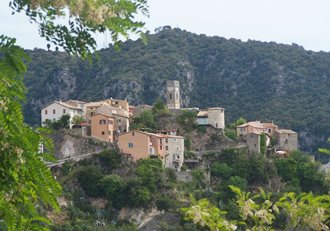
most picturesque hill town along the entire route, Bonson. What
was once the strategically best location for a tower to see who
is approaching the city walls, is today the aesthetically most
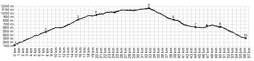
interesting location for such a structure. The first pass, but just a shoulder point along this route is
Col de Rostan (617m). It would be the highest point along the
route, if you would take the next left and descent back down to
the river Esteron. There is no Col sign here. One map that it is
marked on is the Freizeitkarte series, derived from opensteetmap.
The next hilltown appears as a halfmoon shaped crest somewhere
over the guard rail, Revest les Roches. The next pass on the ridge, again just a shoulder point is
Col de St Michel pres Toudon. D27, traversing ever further up
the ridge reaches a little higher than this pass. But with the
help of two roads down to the Esteron, this can again be made
into the highest section of a loop ride also. There is an
informal pass sign here. The next sign of human habitat,
Tourette du Chateau, has a scenic viewing arcade with benches
into the valley next to the main road. For me this made a
great picnic spot. There is an interesting out and back hill climb before the
next hilltown is reached. See the sidetrip to Mt Vial below.
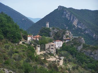
Toudon sits on the hillside below the Cime de la Clappe, and its
conglomerated housing aggregate looks just like a concrete
waterfall, when seen from this angle. The cemetery is an
elevated viewing platform on the town and the mountains. I hope
the dead somehow have the facility to appreciate this grand
location. The route takes on more of a wilderness character, as it
traverses across a cliff of crumbly rock to disappear in dense
forest again. The grand traverse along the hillside continues.
The route crosses one more pass as a shoulder point, Col de Ve
Gautier (1069m). It looks that if you would want to make this
the highest point on a loop ride, you would need to ride the
unpaved descent to the Esteron. The forest become scarcer, and
the town of Ascros appears behind a dilapidated guard rail. It
is just a row of houses, flanking the a lip like rock outcrop,
crowning a gentle ridge.
Following the profile further, the route passes through a
slot canyon between two blocks of limestone, that resemble two
side by side gravestones, speeds past another medieval outpost
with stratigically situated tower on top of cliffs in Sigale,
and finally comes to rest in a town sitting on the valley bottom
for a change, Roquesteron.
Finally the road reaches the crest, traverses the last km along the ridge in wild meanders, and opens up a grand panorama onto the Mercantour range, Near the end of the road at the transmission facility, there is a singed turnoff onto a rough hiking trail over the lower Col de Serse down into the upper valley of the Vars Dayride COMPLETELY PAVED
|

|
|
advertisement |
|
|
advertisement |