| |
| |
FR103 Chimney Rock Rd s(u)
This pleasant dirt road is one of
two continental divide crossings, east of Muddy Pass.
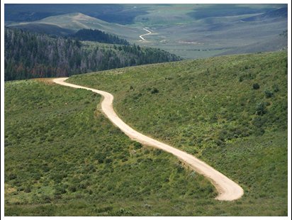
There are some great views on the south side. Both
of these make great loop rides, combined with Muddy Pass,
if you like to combine pavement with good dirt
roads. There are no towns, accessible houses or
even shelters with roofs along the way. Whatever
buildings there are along this route belong to
ranches on private land behind "no trespassing"
signs. So it's a good idea to have one's own
protection for whatever may be coming down from
above.
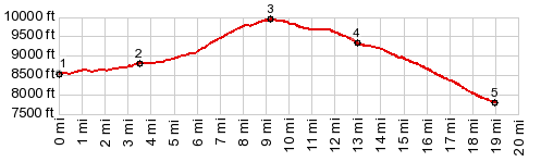
The road crosses the continental divide at an
unmarked cow grade in the forest. After that it
descends a few yards, and then traverses a bit
higher than the cow gate. reaching its highest
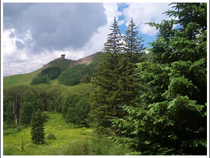
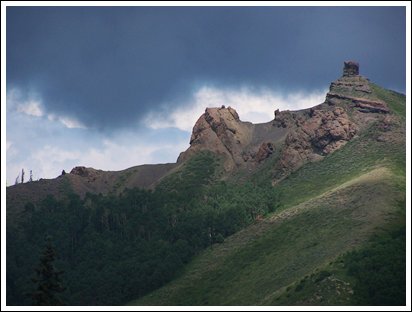
point at the jct with FR107. From South. (described downwards) This side has more views. First comes Chimney Rock (10146ft), then another pedestal rock that looks like some sort of ornamental topping on a wine bottle. Below lies another triangular mountain that has landmark features, Whiteley Peak (10115ft) which is also a landmark from Muddy Pass. A trail branching off to the north, just before
leaving National Forest Land goes to Indian Pass.
This pass is lower than this road, and access on
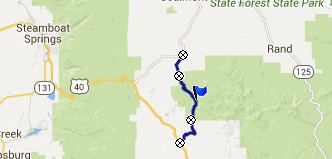
the west side crosses private land. PARTIALLY PAVED / UNPAVED (<Wyoming Trail s(u) | FR700 Chimney Rock s(u) >) FR103 Chimney Rock Rd s(u) , Muddy Pass , addtional out and back : a short distance on FR100 , near south side of Rabbit Ears Pass > US40 east > Muddy Pass(shp) > Co14 north > FR53 Indian Creek Rd south > FR103 Chimney Rock Rd s(u) > FR103 west > US40 north > Muddy Pass > back to starting point near Rabbit Ears Pass: 51.0miles with 3940ft of cllimbing in 4:49hrs (Garmin etrex30: m5:15.7.5). |
|
|
advertisement |
|
|
advertisement |