| |
|
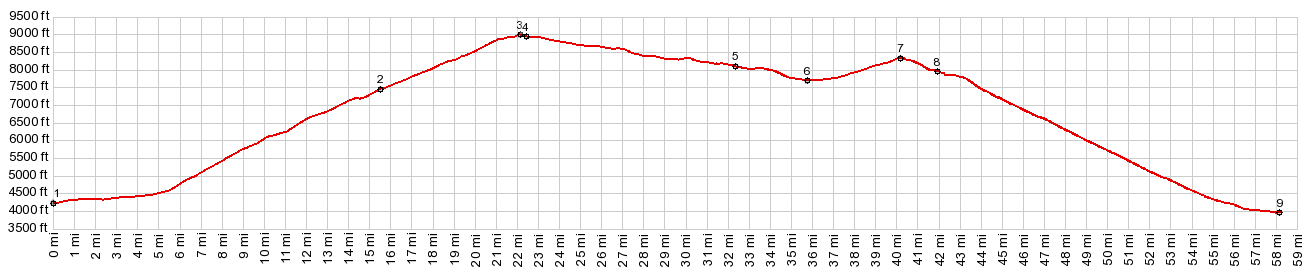
1.(mile00.0,4220ft) START-END WEST: US14 crosses Shell Creek, immediately north of Shell
2.(mile15.5,7450ft)jct with FR17 Battle Creek Rd/Paintrock Rd on right
3.(mile22.0,9033ft)TOP: Granite Pass
4.(mile22.4,8950ft)FR10 Hunt Mtn Rd takes off on right
5.(mile32.4,8110ft)Burgess Jct
6.(mile36.0,7700ft)low point between Granite Pass and Cutler Hill, where US14 crosses south Tongue River
7.(mile40.2,8340ft)Cutler Hill s(u)
8.(mile41.9,7970ft)jct with Black Mountain Road on right
9.(mile58.1,3960ft)START-END EAST: Dayton
|