| |
|
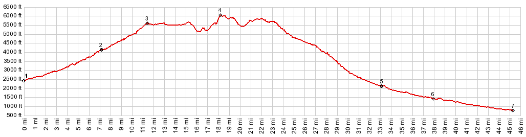
1.(2460ft,mile00.0)START-END
SOUTH: jct US97-Liberty Rd
2.(4120ft,mile07.1)jct FR9718-9712
3.(5650ft,mile11.4)jct FR8712-FR35 heading south
4.(6030ft,mile18.2)TOP: point of highest elevation
5.(2160ft,mile33.1)jct with Peavine Canyon Rd, leading
to No2 Canyon in Wentatchee on right
6.(1450ft,mile37.9)START-END NORTH: jct Sand Creek Rd
- FR7100
7.(760ft,mile45.3)START-END NORTH: Cashmere, bridge
over Wenatchee River
|
|
-