| |
|
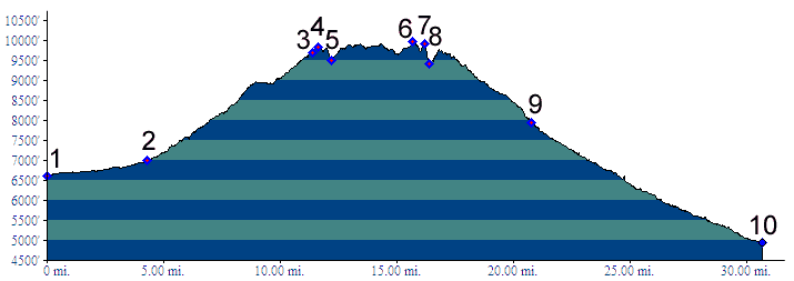
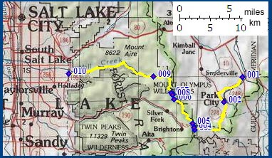
01.(6620ft,mile00) START-END EAST ALTERNATE: Keetley Juction: jct: US40 - Ut248
02.(7000ft,mile05) START-END EAST: Park City
03.(9710ft,mile11) Guardsman Pass
04.(9840ft,mile12) summit between Guardsman Pass and Scott's Pass
05.(9470ft,mile12) Scott's Pass
06.(9970ft,mile16) TOP: highest point
07.(9930ft,mile16) junction with Beartrap Fork on left
08.(9420ft,mile16) junction with Desolation Trail on left
09.(7960ft,mile21) Mill Creek Canyon trailheads
10.(4940ft,mile31) START-END WEST: jct Mill Creek Canyon - Wasatch Blvd ( Salt Lake City )