| |
|
Paved approaches
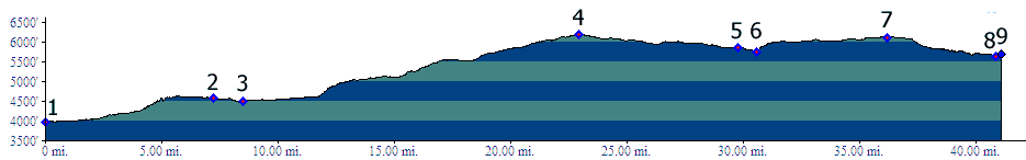
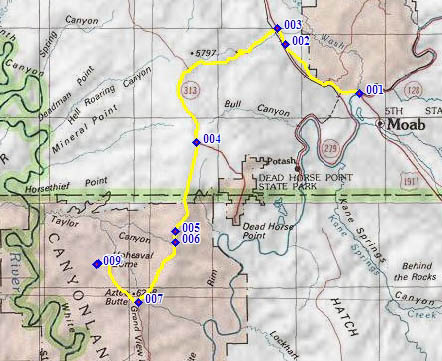
1.(3960ft,mile00) START-END SOUTH: Colorado River Bridge north of Moab
2.(4580ft,mile07) Gemini Bridges trailhead
3.(4500ft,mile09) profile turns left on US191
4.(6184ft,mile24) TOP: turnoff to Dead Horse Point is on left
5.(5860ft,mile30) Canyonlands NP visitor center
6.(5740ft,mile31) the Neck
7.(6110ft,mile37) road to "Grand View Point" goes left. Profile stays right. jct with road to Green River viewpoint is shortly afterwards.
8.(5640ft,mile41) START-END WEST ALTERNATE: low point before Upheaval Dome area
9.(5700ft,mile42) START-END WEST: Upheaval Dome Picnic Area
Long's Canyon Approach
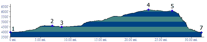
1.(3960ft,mile00) START-END SOUTH: Colorado River Bridge north of Moab
2.(4580ft,mile07) Gemini Bridges trailhead
3.(4500ft,mile09) profile turns left on US191
4.(6184ft,mile23) TOP: (p5 above) turnoff to Dead Horse Point is on left
5.(6080ft,mile27) Pucker Pass, intermediate high point, at a turnoff on left side
6.(3960ft,mile32) START-END EAST: Long Canyon terminates on Ut279, north of Potash
