| |
|
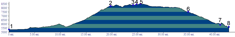
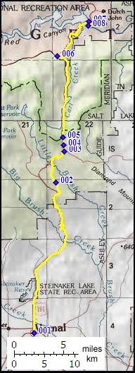
01.(5330ft,m00) START-END SOUTH: Vernal
02.(8240ft,m20) paved forest road 018 leaves on left
03.(8350ft,m25) forest road 048 leaves on right
04.(8428ft,m25) summit sign at 8428ft
05.(8490ft,m26) TOP: unmarked point of highest altitude
06.(7520ft,m35) profile turns right onto US191 to Flaming Gorge
07.(6000ft,m41) Flaming Gorge damn followed by turnoff to Green River in Red Canyon
08.(5650ft,m43) START-END NORTH: picnic area on Green River in Red Canyon