| |
|
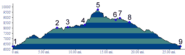
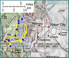
1.(6300ft,mile00) START-END EAST-SOUTH: Cascade Springs
2.(8030ft,mile07) Alpine Loop Road summt and beginning of Ridge Trail
3.(8080ft,mile09) junction with Tibble Fork trail on left.
4.(8310ft,mile12) a double track trail crosses the Ridge Trail. Left connects to Mill Creek; right to Cascade Springs.
5.(9740ft,mile14) TOP: point of highest altitude
6.(8850ft,mile16) Sandy Baker Pass
7.(8930ft,mile17) Pole Line Pass
8.(8550ft,mile19) profile continues right to Cascade Springs
9.(6300ft,mile27) START-END EAST-NORTH: Cascade Springs