| |
|
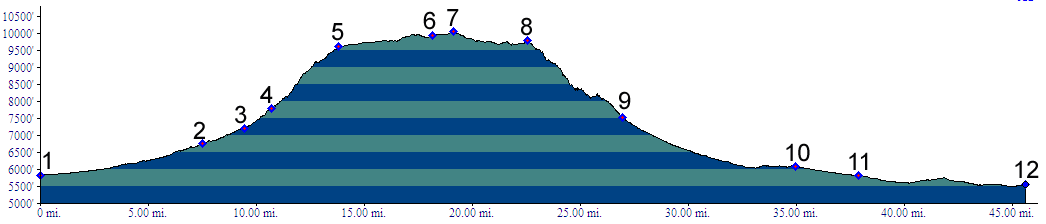
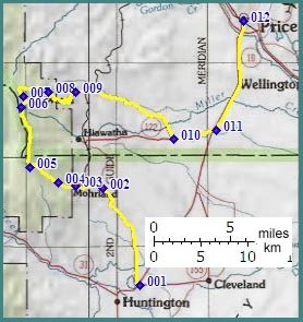
01.(5810ft,mile00) START-END SOUTH: jctUt236-Ut11, north end of Huntington
02.(6780ft,mile08) START-END SOUTH ALTERNATE: right connects with Hiawatha, profile continues straight
03.(7210ft,mile10) site of Mohrland
04.(7789ft,mile11) site of Mohrland Mine
05.(9610ft,mile14) profile continues right on FR111
06.(9930ft,mile19) profile turns right onto FR249
07.(10046ft,mile20) TOP: point of highest altitude
08.(9780ft,mile23) communication towers at Star Point
09.(7550ft,mile28) Wattis Mine
10.(6090ft,mile35) turn left onto Ut122
11.(5820ft,mile38) START-END NORTH: profile continues left on Ut10
12.(5550ft,mile46) START-END NORTH ALTERNATE: Price