| |
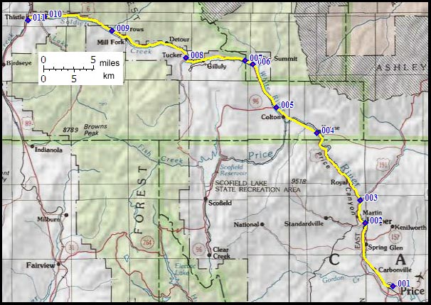
|
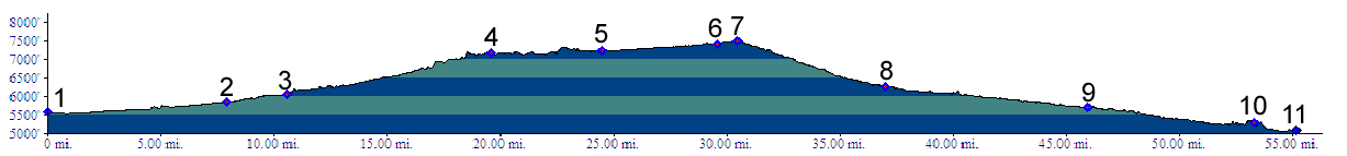
01.(5570ft,m00) START-END EAST ALTERNATE: downtown Price
02.(5850ft,m07) START-END EAST: Helper
03.(6080ft,m11) site of Carbon Plant; paved Ut33 on right goes up to Indian Canyon summit.
04.(7180ft,m20) paved Emma Road on right also heads for Indian Canyon summit
05.(7240ft,m25) Ut96 on left goes up Spring Canyon. Profile continues straight.
06.(7410ft,m30) dirt road on right heads towards Reservation Ridge
07.(7477ft,m31) TOP: Soldier Summit
08.(6270ft,m37) Tucker rest area and junction with Skyline Drive
09.(5690ft,m46) paved road up Sheep Creek leaves on right
10.(5300ft,m53) profile continues left onto US89 towards Thistle
11.(5080ft,m56) START-END WEST: site of Thistle at Thistle Creek