| |
|
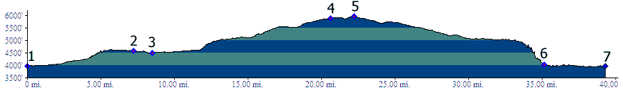
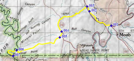
1.(3960ft,mile00) START-END EAST ALT: Colorado River Bridge north of Moab
2.(4580ft,mile07) Gemini Bridges trailhead
3.(4500ft,mile09) START-END EAST: profile turns left on US191
4.(5890ft,mile21) profile turns right onto Mineral Bottom Rd
5.(5960ft,mile23) TOP
6.(4030ft,mile36) profile stays left. Right fork goes to Mineral Bottom and boat ramp
7.(3980ft,mile40) START-END WEST: Saddle Horse Bottom