| |
|
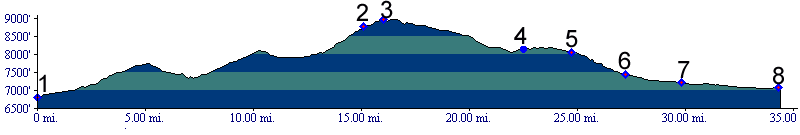
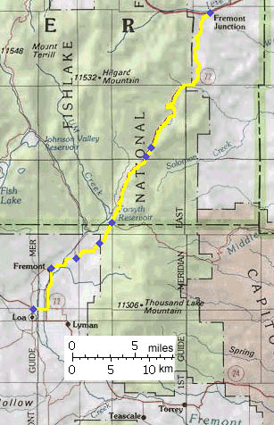
1.(6810ft,mile00) START-END NORTH: Fremont Junction. I70 exit is at 6520ft a short disance north
2.(8820ft,mile15) Hogan Pass
3.(8980ft,mile16) TOP: high point
4.(8160,mile23) junction with dirt road FS206 on left
5.(8060ft,mile25) paved road joins from Johnson Valley Reservoir on right
6.(7440ft,mile28) road on right joins with road at point 5.
7.(7230ft,mile30) Fremont
8.(7090ft,mile35) START-END SOUTH: Loa