| |
|
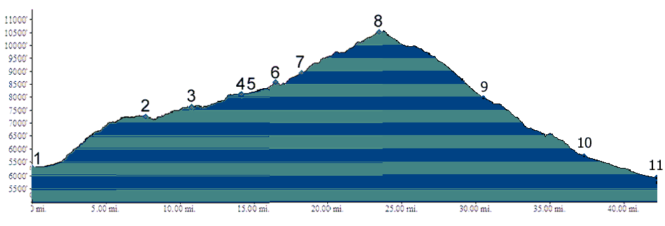
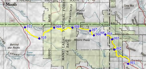
01.(5300ft,mile00) START-END EAST-NORTH: Paradox
02.(7260ft,mile07) junction with dirt road on left. Profile continues straight
03.(7630ft,mile11) Buckeye Reservoir
04.(8350ft,mle15) junction with dirt road on left. Profile continues straight
05.(8360ft,mile15) dirt road on left goes to Canopy Gap. Profile continues straight
06.(8580ft,mile17) stay right at fork
07.(8950ft,mile19) go left up much less traveled route. This turn off is easy to miss
08.(10538ft,mile25) Geyser Pass. Profile continues south towards La Sal. Straight goes to Moab.
09.(7950ft,mile) profile turns left onto La Sal Loop Rd.
10.(5720ft,mile) road following Pack Creek joins from left
11.(4860ft,mile) START-END WEST: jct La Sal Loop Rd - US191, south of Moab