|
|
|
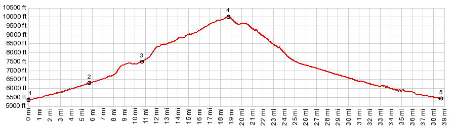
1.START-END EAST:end of Nine Mile Canyon
Rd - start of Cottonwood Canyon
2.jct with Cottonwood Ridge Rd on left
3.jct with Flatiron Mesa Rd on right
4.TOP:100020ft jct with Water Canyon Rd and option do
descend on west side
5.START-END WEST:jct Nine Mile Canyon Rd - Dry Canyon
|