| |
|
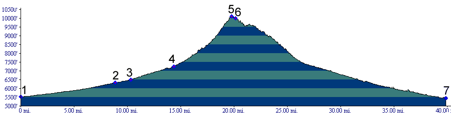
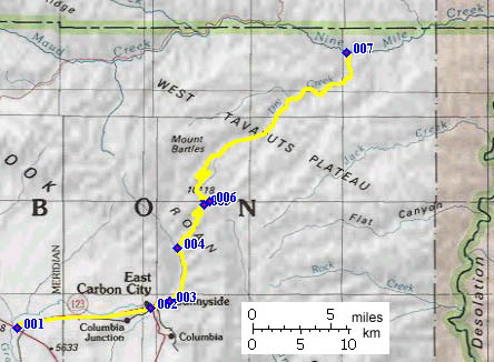
01.(5520ft,mile00) START - END SOUTH:
Sunnyside Junction: Ut123, US6
02.(6440ft,mile09) East Carbon City
03.(6510ft,mile11) Sunnyside
04.(7250ft,mile15) route turns right off main road, up Water Canyon
05.(10131ft,mile20) TOP: Bruin Point summit(u)
06.(10004ft,mile21) profile continues to Dry Canyon, left fork at this intersection
07.(5440ft,mile40) START - END NORTH: junction Dry Creek Canyon, Nine Mile Canyon Road