| |
|
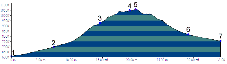
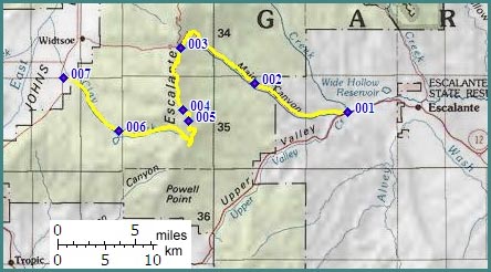
1.(6110ft,mile00) START-END EAST: jct Ut12 - FR17 Main Canyon, several miles west of Escalante
2.(6990ft,mile08) dirt road on left connects back to Ut12
3.(9302ft,mile15) Main Canyon summit. Right goes to Griffin Top. Profile continues left onto double track trail
4.(10510ft,mile20) turnoff on right goes to radio tower
5.(10580ft,mile21) TOP: Barney Top
6.(8190ft,mile30) turnoff on left goes to nearby Pine Lake with campground
7.(7550ft,mile35) START-END WEST: jct Ut22 - dirt road up Clay Creek